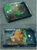
 Students of all ages enjoy using clay for art projects, but try using it for geography projects as well! Using clay is a great way for students to learn vocabulary/tearms of physical geography features. For this project, send the following clay recipe home with students a couple of weeks prior to the activity date...ask them to make three batches of clay if possible in different colors: blue, green, & white (plain/no color). This recipe is one of the best that I have used for clay projects, because it's 1)fairly easy to make, 2) can be repeatedly re-used for different projects (if stored in plastic zip-bags or containers), and 3)projects made from this clay dry slowly, hold together for quite a while (and do not crack/fall apart).
GLOBAL "PLAY-DOUGH" recipe:
MIX:
1 cup flour
1 cup water (food coloring can be added here)
1/2 cup salt
1 tablespoon vegetable oil
1 teaspoon cream of tarter
COOK:
Cook the above ingredients in a cooking pot over low heat...stirring constantly...until thick and lumpy. ( the dough will stir into a ball)
KNEAD:
When the dough has cooled, knead the dough for several minutes. (If the dough is too wet or sticky...it's not "cooked" enough...reheat in pan).
Let kneaded dough cool completely...store in plastic zip bags or plastic containers. The dough can also be refridgerated.
Global "play-dough" physical features ideas:
1) cut 6 in x 6 in squares of poster board or cardboard. Write three similar physical features vocabulary words on each board. Give each student (or pairs of students) a vocabulary board & clay...they must look up the definition of the words...& write them on the back of the card. Then the students use small amounts of clay to "model the physical feature".
Examples of geography physical features words for the cards:
key, island, boundary
source,lake, upstream
tributary, plateau, mesa
mt. pass, butte, canyon
island, bay, shore
point, reef, ocean
reef, compass rose, harbor
delta, harbor, bay
mesa, butte, plain
plain, peninsula, cape
cape, point, gulf
gulf ,bay, strait
boundary upstream island
mt, lake, forest
mouth(river), source, river
hill, plain, downstream
Students can make little labels to identify each physical feature...attach the labels to straight pins or toothpicks and insert into the clay. Students show the class their finished physical features definitions and "models"...As the students are explaining their models, the rest of the class writes the definition and sketches a pictures of the model as well. The students notes/sketches could be taken on a worksheet, journal, or 11x17 art paper folded into 16 squares.


No comments:
Post a Comment