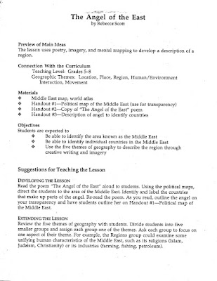
Years ago I picked up this lesson plan during a geography conference ... fabulous VISUAL, hands-on ...to help kids remember the countries of the Middle East.
A couple of pages are missing from the original lesson plan now though., and so I have tried to locate this lesson plan on the internet to no avail. I'm reconstructing a couple of the items so as to provide a complete lesson plan here. (double click on images to enlarge and print).
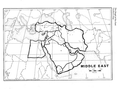
Give students a blank, black-line outline map of the Middle East. Tell them an "Angel of the East" will appear when they hear the following poem..and the poem will help them learn the countries of the Middle East Region. Have them listen for clues in the poem as you read outloud (or show on smart board/chalkboard/overhead transparency). Outline the "Angel" on the map with a marker as countries/clues are given in the poem:
The Angel of the East (teaching poem)
byRebecca Scott
If you could look east
across the United States,
over the Atlantic Ocean and
the Mediterranean Sea
to a place between
Asia, Africa, and Europe,
you might see an angel--
and angel of the east--
setting on a sea of blue.
Her head hangs heavily, (Turkey)
bowed towards her chest ( Lebanon, Syria,)
as she holds her hands
together in prayer
facing west. (Egypt)
A tear has fallen
from her cheek. (Cyprus)
Her heart aches; (Israel)
the heart of three religions.
She would like to be
the angel for all people,
but it seems remote
on this southwest peninsula.
She is battle-worn
and war-torn,
this angel of the east--
praying someday for
a new world order and peace.
Other angel parts to identify:
wings (Iran, Afghanistan)
shoulder/arms (Iraq, Jordan)
body/dress (Saudi Arabia)
dress hem (Yemen, Oman, UAE)
Buttons on dress (Kuwait, Quatar, Bahrain)


