 Podcasts of previous EARTH & SKY related programs:
NGS Daily jigsaw puzzles
Wednesday, April 29, 2009
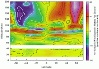
Atmospheric Tides?
 Podcasts of previous EARTH & SKY related programs:
Monday, April 27, 2009
Previous Earth & Sky programs ....shared!!

What to do now with all the EARTH & SKY CD's ? I contacted EARTH & SKY to see if I could have permission to use some of the topics from the CD subscriptions on this blogsite. They agreed, and gave me written permission to use them here! Thank You "Deborah Byrd" (of "Block and Byrd") for giving permission to use the past episodes!!
1-click on the shared links below for podcasts
I found several websites about the National Dinosaur Museum including lesson plans that could be used to support the above "podcasts":
http://news.nationalgeographic.com/news/2003/03/0307_030310_dinotracks_2.html
http://www.dinosaurdiamond.org/Teacher_Resource.html
http://historytogo.utah.gov/utah_chapters/from_war_to_war/dinosaurnationalmonument.html
Friday, April 24, 2009
Discover Antarctica
http://ngm.nationalgeographic.com/ngm/antarctica/
The map shows all the different animal species and their ranges, videos/critter cams, physical geography, glossary, interactive quiz, and other resources & links, wallpaper, history of explorations, and NGS archive information...
This would be a great interactive website for use during your school's computer lab time, on a single computer or smartboard.
Skywatch Friday
Wednesday, April 22, 2009
World Digital Library Project
World Digital Library Project www.wdl.org.
The directors of this project are partnering with WORLD governmental institutions (example: U.S. Library of Congress / National Archives) to "make available on the Internet, free of charge and in multilingual format, significant primary materials from cultures around the world, including manuscripts, maps, rare books, musical scores, recordings, films, prints, photographs, architectural drawings, and other significant cultural materials. The objectives of the World Digital Library are to promote international and inter-cultural understanding and awareness, provide resources to educators, expand non-English and non-Western content on the Internet, and to contribute to scholarly research."
http://www.wdl.org/en/ is an easy to use website, with a world map showing all current digitized documents available ....
What an incredible project! The World Digital Library is digitizing to preserve rare cultural primary resources documents spanning thousands of years of history from cultures around the world!!!
Friday, April 17, 2009
Sky Watch Friday
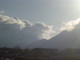 SKY WATCH FRIDAY:
See other fascinating sky views @
http://skyley.blogspot.com/
Ah, Spring in the Rockies!...Or at least along the Wastach Front portion of the Rocky Mountains!
Last weekend was lovely, sunny and warm (upper 60's)...the snow had melted so only the Mountain tops were snow covered. Then this week, Winter tried to return!! This picture was of the approaching storm front blowing in across the Salt Lake City toward the Wasatch Mts!! It has been raining, snowing, blowing, and COLD ever since. In fact, yesterday 4/16/09 the snow storm left 10-14" of snow in our surrounding area of Northern Utah County, Utah. The snow had a lot of moisture and most of it melted by last night.....Another storm is blowing in today. Needless to say, the Mountains are covered from top to bottom with snow again. Oh well, the extra "wet" snow will help fill our depleted water reserves!!!!!!!!
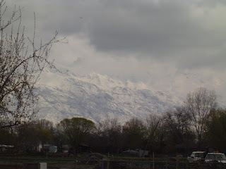 This picture just taken...mountains covered from top to bottom...again.
Celebrate Earth Day art projects

Geography / Map resource!!
Maps That Teach: Free U.S. and World Maps and Puzzles http://www.yourchildlearns.com/geography.htm
"Maps that Teach take advantage of the fact that geography is spatial. They also utilize the way kids learn best, by actively participating in their learning; learning by doing. As students assemble the maps, they build a permanent mental picture of their world. From Maps that Teach, a student will learn about the continents and where they are in relation to each other; the countries of the world, their capitals and major cultural landmarks, physical features; what is far and what is near."
All kinds of printable maps (world,continents, countries, states, world regional maps,etc), map puzzles, online interactive maps, world atlas, BIG sized maps for download and printing..
Most of the printable maps, are basic outline (not labeled) maps...easy to use and print.
Very user-friendly site for teachers & students!!
Tuesday, April 14, 2009
The Great Turtle Race
Follow the Leatherback Sea Turtles' 3,700 mile migration journey online @:http://animals.nationalgeographic.com/animals/article/greatturtlerace.html


From the Great Turtle Race website:
"Eleven leatherback sea turtles are racing from foraging grounds in the frigid waters of Canada to nesting beaches on the sun-soaked shores of the Caribbean. The turtles are tagged with state-of-the-art satellite tracking devices that allow us to follow their incredible 3,700-mile (6,000-kilometer) journey. Which turtle will reach the finishing line first? Which will dive the deepest or go the farthest afield?
The race begins on Thursday, April 16. Watch the turtles' progress on our race map—updated every day—and sign up for daily race updates from Conservation International.Thank you to our sponsors and field partners for their support. (Will go live when info available). Learn more about the history of the Great Turtle Race.-->"
Also on The Great Turtle Race website:
- Sign up for daily turtle location updates! (Have your students map the turtles' journeys from these daily race updates).
- Watch a turtle-cam video.
- Get facts: info from the Leatherback Creature Feature.
- Learn about saving/protecting Leatherback and other Sea Turtles.
- Do a sea turtle jigsaw puzzle, and much more......
Thursday, April 9, 2009
3G on W3
Wednesday, April 8, 2009
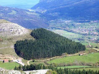
Earth "hearts"
 : All things Geography blog.
http://geolounge.com/
A recent entry titled
9 Gigantic Hearts From Above
was pretty cool....showing
Earth "hearts"....
Warning!
http://damncoolpics.blogspot.com/2008/12/9-gigantic-hearts-from-above.html This particular log is a great link....but other content on the site is not appropriate for kids!!!!!!!!
Future Geographic Bee Winner
WOW!!!! This little girl will surely be a future National Geography Bee winner, the President of National Geographic's Cartography Department, President of Google Earth or.... You Go, Girl! .....Stop at nothing less than the U.S. Embassador to the World....
Tuesday, April 7, 2009
Easter -- Pysanky Eggs
 Ukrainian Pysanky "Easter Eggs"
http://www.readwritethink.org/lessons/lesson_view.asp?id=996
Thursday, April 2, 2009
SkyWatch Friday
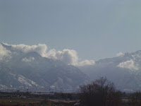
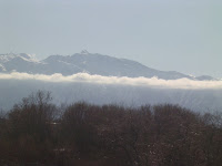
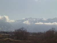
 Last week, an interesting string of clouds passed in front of the Wasatch Front Mountains looking east from the Salt Lake Valley, Utah: Mt. Olympus, Lone Peak, Big and Little Cottonwood Canyons. It was one of the few warm, but very windy, days we've had so far this spring in Utah.